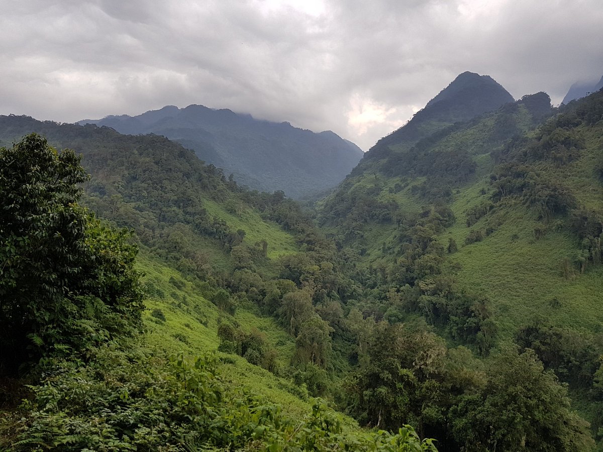
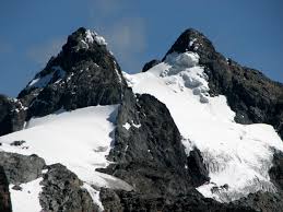
The Rwenzori mountains are found in the western Uganda in the eastern arm of rift valley extending across the Democratic Republic of Congo and Virunga National Park. The Rwenzori mountains also known as Rwenjura or Rwenzururu are ranges of mountains with 6 peaks separated by gorges for instance; Mount Luigi di Savoia 4,627m, Mount Gessi 4,715m, Mount Emin 4,798 m, Mount Baker 4,843m, Mount Speke (4,890m), and Mount Stanley at 5,109m. Mount Stanley has other minor peaks, with Margherita being the highest peak making it the third highest in Africa. The upper regions of these ranges are permanently snow-capped and glaciated.
These mountains are located in Rwenzori Mountain National park that covers an area of 996 sq kms with rocky outcrops, lakes, cliffs, and different vegetation zones. The park was gazetted and recognised as a World heritage site in 1991. Later in 2008 the protected area was recognized as a Ramsar site. Hiking the Rwenzori mountains takes from 7 to 12 days to complete the trek to the peak depending on the routes one uses. There are other itinenaries for instance 9 days mountain Rwenzori hiking. These treks go through the Bakonzo villages.
The Rwenzori Mountains have different hiking routes, each providing a unique experience with different attractions along the way. Some of these hiking trails include:
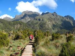
The Central Circuit Trail is the shortest and most popular old tracking route used by mountaineers to Margherita peak. The trail starts from Mihunga gate and passes through Bukuju via John matte and Nyabitaba. Then the trail leads to other peaks to the scott elliot pass to lake Kitandara, Elena Glacier and Bujuku valley. Further it navigates through different vegetation zones that offer views of Mount stanley, Mount speke and the weismann peak. The trail crosses the lower and upper bigo bogs which support the boardwalks in the area. Also the route follows thick forests that are habitat to different mammal and bird species. For Instance; forest elephants, forest buffaloes, hyraxes, L’Hoest monkeys, black and white colobus monkeys while birds include; handsome francolin, strange weaver, barred long tailed cuckoo, and Rwenzori Turaco. Along the way there are distributed huts that are used for overnight stays by the Mountaineers. These huts are weather condition tolerant. The safaris along this trail typically takes around 6 to 7 days to complete depending on one’s strength and preference. The central circuit trail is managed by Rwenzori mountaineering service owned by the locals around Rwenzori mountains.
The Kilembe Trail also known as the southern circuit located 14 km west of Kasese municipality and managed by the Rwenzori Trekking service (RTS). The trail starts from the town of Kilembe and passes through lush montane forests, bamboo zones, and alpine. It also follows the combination of trails along the Kamusoni, Nyamugasani and Nyamwamba river valleys. Professor Scott Elliot first discovered this route in 1895 before Luigi di Savoia had developed another route from Nyakalengija via the Bujuku valley. Using the Kilembe trail the hiking distance to the peak is longer compared to when one has used a central circuit. Being the longest route, Kirembe trail offers climbing experience and views of glaciers, lake Muhoma as well as flora and fauna. This will also lead to pushing the excursion for more days.
Lake Mahoma Trail is another alternative to the central circuit and was opened in 2012. The route is short and more wildlife oriented. Mountaineers hike from Nyakalengija trail at an altitude of 2088m into bamboo forest where the glacial lake Muhoma offers a view of the high peaks. The trail takes 2 to 3 days to complete and offers scenic views of waterfalls, rivers, and dense forests. Tourists are able to see different mammal species along the way like L’Hoest monkeys, blue monkeys, black and white colobus monkeys, forest elephants and forest buffoles. The trail is suitable for hikers of all fitness levels and provides opportunities for cultural encounters with local communities.
The Bukunguru trail was developed after the central circuit and Kilembe trail. The trail is mostly used by wild nature enthusiasts and those who like camping. Along the route there are four lakes for instance; Irene, Bujuku, Mughuli and Bukunguru. These are accompanied by the mountain rivers and waterfalls. This trail takes 8 days to complete or to reach Margherita peak. There are no huts though having safe organized areas and all the routes on this trail are managed by the Bujuku eco tours.
However as of May 14 2024, Uganda Wildlife Authority temporarily suspended hiking activities to Margherita peak in Rwenzori National park. The organization came up with the decision of installing a permanent ladder on the right side of Margherita glacier as precautionary measure for the crevasse formation in the Margherita glacier. This alternative route offers secure passage for hikers
Best time to climb Rwenzori mountains
Climbing Rwenzori mountains can be done any time around the year, although the best time to climb is during the dry seasons that occur from June to August and December to February. During these months, the weather is generally more stable with lower chances of rainfall and tourists are able to see Rwenzori mountain at its finest. During the months of December to February the weather tends to be steady with warm days and cold nights. Tourists in these months are able to climb up to the peak and summit the margherita. Also this short period of time offers tourists an opportunity to see Rwenzori mountains at their best.
Mountain Rwenzori national park is visited more often during these months of dry season and tourists get the opportunity to enjoy the chilly weather around the mountains. However, the Rwenzori Mountains can experience rainfall at any time of the year due to their proximity to the equator. Even during the dry seasons, it can drizzle and tourists should be prepared for variable weather conditions regardless of when you choose to climb.


