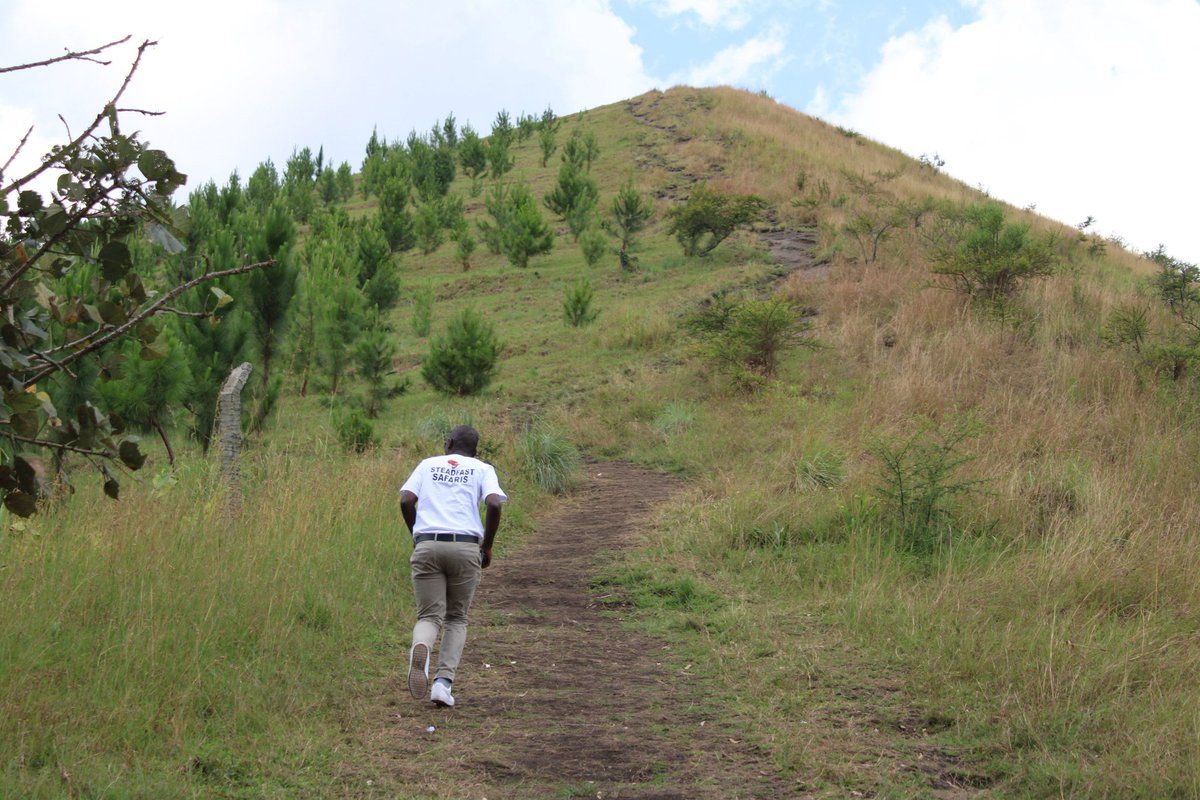
The Kyeganywa hill is located in Kabarole district near Kabindikwa and Kangolya town a few kilometers from Fort Portal City western Uganda. The hill is 1588 meters above sea level. Hiking Kyeganywa hill offers entire views of Fort Portal city and Rwenzori mountains. Since the place is dotted with crater lakes, the top of this hill offers a panoramic 360 view of three crater lakes for instance lake Kigere, Saaka and Nyabikora. In case one wants to have clear views of lake Saaka you have to climb up to the top of the hill. Climbing Kyeganywa hill takes an hour to and fro.
Tourist attractions near Kyeganywa hill
Amabere ga Nyina Mwiru caves
The caves are located in Nyakasura village 10 kms away from FortPortal city and 32 kms from Kibale forest National park. Amabere ga Nyina Mwiru means the breasts of Nyina Mwiru where the caves got their names. Nyinamwiru was a daughter to king Bukuku of the Batembuzi dynasty in the 14th century. The Batembuzi were believed to have demigods and supernatural powers as they could vanish in the air. The caves are built on the folklore of Nyinamwiru’s refusal to get married to the man her father King Bukuku had chosen. Her disobedience maddened her father and the subjects were embarrassed on how the king was disobeyed. Later the king decided to cut off her breasts and threw them in the caves. This was done so that no man could fall for Nyinamwiru and also she couldn’t breastfeed her kids. However other stories state that the cutting of Nyinamwiru’s breast was done following the prophecy the king got. The prophecy stated that Nyinamwiru would marry and produce a son called Ndawura who would kill the king and take over the kingship. King Bukuku was not happy with this so he decided to cut off his daughter’s breasts, deforming her so that no man would fall for her. Little did he know that Nyinamwiru was pregnant already. Geographically, these breast-like features on the caves explain the stalactites and stalagmites. These features were formed as a result of chemical reactions between water and the limestone. Within the Amabere caves there are three crater lakes, footprints of the demigods and waterfall.
Kibale forest National park
The national park is located in western Uganda covering an area of 795 sq kms most covered with tropical forest. Kibale forest National park is famously known for having the highest number of the primates in East Africa with the most popular activity being chimpanzee tracking. The park boasts 120 mammal species including 13 primate species. For instance chimpanzees, black and white colobus monkeys, olive baboons, red tailed monkeys, L’Hoest monkeys among others. Other mammals include; elephants, antelopes and buffaloes. The primates walks are done in different centers within the park; these include Kanyanchu visitors center for chimpanzee trekking. Bigodi swamp is used for birding and other primates watching. The forest is also a home to 370 birds including 23 Albertine rift endemics; these include; blue headed bee eater, lowland masked apalis, cassin’s spinetail and Nahan’s Francolin.
Semliki National park
 The park is located in the western region of Uganda, Bundibugyo district sharing its borders with the Democratic Republic of Congo (DR Congo). Semliki National park is nestled between Lake Albert to the north and the Rwenzori Mountains to the east and surrounded by the Lamia and Semliki rivers. The protected area was originally established as the Bwamba forest reserve in 1932. Later in 1993 it transformed into a national park with an aim of combating deforestation and preserving the area’s biodiversity. Semliki boasts an array of 60 mammal species and over 435 bird species. The birds checklist features 35 Guinea-Congo forest biome bird species which are endemic to East Africa. These include Congo serpent eagle, red-rumped tinkerbird, Gabon woodpecker, spot-breasted ibis, black dwarf hornbill, Hartlaub’s duck, long-tailed hawk, and chestnut-flanked goshawk. The park’s ecosystem extends to the insect population. Semliki has over 300 butterfly species, including 46 species of forest swallowtail and 235 moth species. The park has a number of tourist attractions for instance Sempaya hot springs, cultural encounters, Semliki river among others.
Rwenzori mountains
The Ruwenzori mountains are also known as Rwenzori or Rwenjura, and sometimes referred to as Rwenzururu, is a mountain range located in southwestern region of Uganda on the eastern side of the Albertine African rift valley. The mountains are along the border with the Democratic Republic of the Congo (DRC) sharing 50 km (31 mi) with DRC’s Virunga National Park. The Rwenzori mountains have six massifs that stretch 120 kms long and 65 km wide. These massifs are separated by deep gorges these include; Mount Stanley (5,109 meters), Mount Speke (4,890 meters), Mount Baker (4,843 meters), Mount Emin (4,798 meters), Mount Gessi (4,715 meters), and Mount Luigi di Savoia (4,627 meters). Among these Mount Stanley boasts many other subsidiary summits with Margherita being the highest. Within the mountains there are over 70 mammal species and these can be seen when hiking the Rwenzori mountains. Among these mammals include Albertine endemics, some exclusive to the park and are classified as rare species. During mountain climbing tourists are able to spot some of these mammals for instance elephants, brushbacks, Rwenzori otters among others.


